
Dallas ZIP Codes and Coverage
Dallas County does not have one simple list that turns every postal code into a city boundary. The working groups below come from official Dallas-area map, election, and technical references. They are practical Dallas starting points, not a promise that every address in the group belongs to the same municipality. The final Dallas check is the Postal Service result for the full address, followed by the parcel and jurisdiction layers when county or city limits matter.
| ZIP or group | Area or delivery lead | Postal reference | Record-search caution |
|---|---|---|---|
| 75001 | Dallas County Addison area | Confirm city and state by address | Read municipal and parcel details separately. |
| 75006, 75007 | Dallas County Carrollton and Farmers Branch edge | Shared suburban delivery area | Use the street address and municipal GIS. |
| 75038, 75039, 75060-75063 | Dallas County Irving and DFW-area codes | Address-specific postal result | Airport and municipal edges need checking. |
| 75080-75082 | Dallas County Richardson area | Richardson delivery lead | ZIP and municipal boundary can differ. |
| 75115 | Dallas County DeSoto area | Verify city, municipality, and county | Do not infer jurisdiction from the code alone. |
| 75149, 75150 | Dallas County Mesquite area | Address-specific confirmation | Boundary differences appear at the edges. |
| 75201-75209 | Downtown, Uptown, Oak Lawn, and central Dallas | Multiple neighborhoods in each code | A ZIP is broader than a neighborhood name. |
| 75261 | DFW Airport and special delivery | Check whether a street address is served | Do not treat it as an ordinary neighborhood area. |
| 753xx groups | Dallas special, post-office, or institutional delivery | USPS confirmation required | These codes are not ordinary residential polygons. |
The research did not locate one official, exhaustive current Dallas County ZIP list with city, county, and delivery classification. That gap is important. A Dallas ZIP code directory should guide address-level verification, not replace it. Note: A delivery code can cross city, county, school-district, and unincorporated boundaries at the same time.
Dallas Delivery Search Modes
The USPS ZIP Lookup provides two useful routes. “By Address” accepts a corporate or residential address with city and state, or an address with ZIP. “By City and State” returns delivery codes for a recognized postal city and includes a Cities by ZIP route. The address mode is the practical test for a particular Dallas place because it returns a delivery answer instead of a broad city list.
| Lookup route | Input | What it answers |
|---|---|---|
| USPS By Address | Street address plus city/state, or address plus ZIP | The delivery ZIP and recognized postal-city result for that address. |
| USPS By City and State | Postal city and state | A list of delivery ZIPs associated with the recognized postal city. |
| DCAD property search | Owner, address, account, business, or map | The appraisal account and parcel context, not a ZIP text filter. |
| DCAD ZIP layer | Map feature with ZIPCODE attribute | Visual ZIP-polygon context for a parcel or road. |
The USPS result does not confirm a person or company. It establishes Dallas postal delivery geography. Once the address is narrowed, the Dallas street directory follows the Dallas address-keyed records trail more closely.
Note: A recognized postal city is a delivery label, not proof of the parcel’s municipality or county.
Dallas GIS Shows Postal Context
Dallas County Public Works routes map and data questions through its GIS resources and refers searchers to county, DCAD, and regional data. The county viewer can provide parcel and jurisdiction context around a reported ZIP. It is useful when a Dallas address lies near a city edge or when a road crosses more than one postal area. Map geometry is an aid to routing, not the legal description that controls a parcel.
Dallas County Public Works GIS is the source for this county GIS routing page.
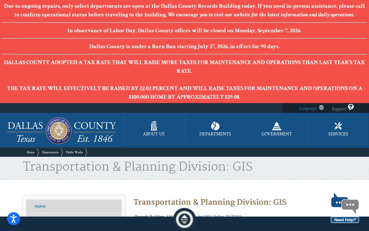
The Public Works route helps identify the right mapping resource when a simple postal answer does not resolve a Dallas County jurisdiction question.
Dallas County GIS Viewer provides the county map interface used for parcel and jurisdiction context.
Compare the address, parcel, road, municipal, and ZIP context before choosing a county office or interpreting a postal-city label.
Dallas ZIPCODE Map Layer
Dallas DCAD’s official ZIP polygon service includes a ZIPCODE attribute alongside geometry fields such as object ID, shape length, and shape area. The layer is valuable for visual filtering and for testing whether a Dallas parcel sits near a ZIP edge. It does not replace the Postal Service assignment for a specific address, and it does not decide legal parcel ownership or municipal status.
DCAD’s Dallas County ZIP layer is the source for the polygon reference.
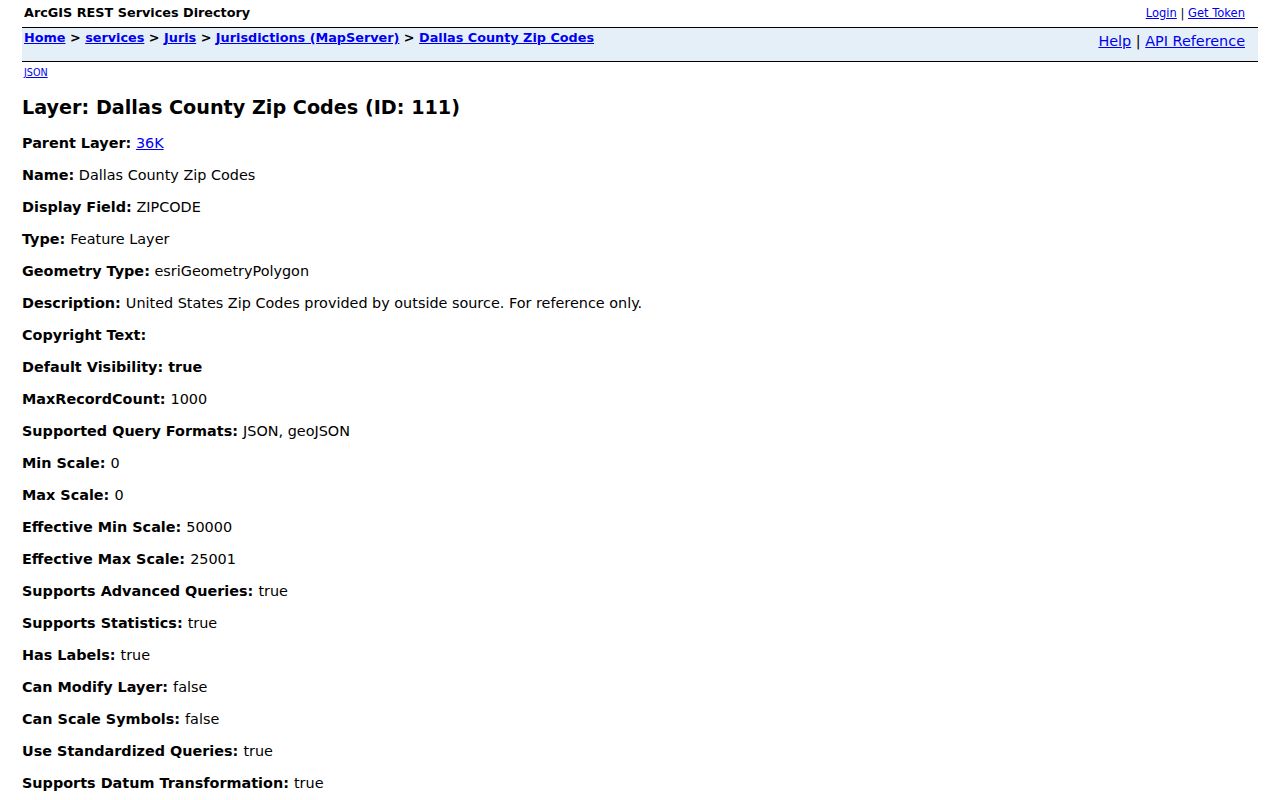
The layer’s ZIPCODE field supports map context, while the full delivery address remains the better evidence for postal assignment.
Dallas Core and Edge ZIP Groups
Central Dallas groups such as 75201 through 75209 contain several neighborhoods, so a neighborhood name should not be substituted for a ZIP or parcel. The outer county groups need even more care. Carrollton, Farmers Branch, Irving, Garland, Richardson, DeSoto, Lancaster, Mesquite, Seagoville, and Wylie appear in the research as delivery-area leads with municipal or county-edge cautions. A recognized postal city can be useful for mail but still differ from the city shown on a local parcel card.
At the north and northeast edges, 75019 is a Coppell and Carrollton lead, while 75098 reaches Wylie and the county edge. In the south, 75104 points toward Cedar Hill and an Ellis County edge; 75125 toward Ferris; 75134 and 75146 toward Lancaster; 75141 toward Hutchins; 75154 toward Wilmer; and 75159 toward Seagoville. The 75180 through 75182 group reaches Balch Springs, Mesquite, and southeast delivery areas. Each is a reason to verify the full address, not a shortcut to a jurisdiction.
Unique, post-office, institutional, and specialized 753xx delivery codes need their own check. The research specifically warns against treating them like ordinary neighborhood polygons. For each case, retain the exact address and date of the postal result. That is more durable than using a ZIP group as a proxy for where a person lives.
Find Dallas Records by ZIP
A ZIP can narrow a Dallas research area, but the appropriate search changes with the record. DCAD’s inspected Dallas address form has number, direction, street, building, suite, city, and account-type controls, not a ZIP text field. Use the address or map route, then read the Dallas parcel details and compare them with USPS. The Dallas GIS ZIP layer is the map counterpart. For a ZIP-specific business location search, the Texas Comptroller uses a five-digit ZIP field, but its results are taxpayer records rather than a resident list.
- Run the full Dallas address through USPS By Address and save the returned ZIP and postal-city wording.
- Open DCAD by address or map to identify the parcel account, situs, and legal description.
- Use the DCAD ZIPCODE polygon and county GIS layers to check city, road, and jurisdiction context.
- Use a record-specific portal only after the correct address and custodian are clear.
For an association or organization question, the state HOA certificate search can filter by ZIP together with city, county, and association type. It identifies association records, not residents or a household roster.
Dallas ZIP Filters Have Limits
The Texas Comptroller taxpayer search has a Location mode that requires a location name of at least two characters and a ZIP of exactly five digits. It also offers all, active, and inactive permit-type choices. For a Dallas County business location, this can distinguish a Dallas listed location from another record, but it cannot establish a private residence or current activity.
The Texas HOA management-certificate search also supports ZIP, city, county, and association-type filters. Use those Dallas fields to identify the correct association or local context. An association certificate can identify an organization, but it cannot establish who occupies a particular Dallas address.
Dallas election-location files may also carry a facility ZIP, but those records are dated to a named election and can change. For a Dallas person, return to Dallas official parcel, court, voter, or historical sources that fit the actual question.
Note: A five-digit field narrows a portal result, but it does not turn that portal into a people directory.
Dallas Election ZIP Evidence
Dallas County election-location documents can show a Dallas facility address, city, and ZIP for a specific election. The May 2, 2026 location notice is marked subject to change, which makes it a dated facility reference rather than a resident record. Dallas County canvass and reconciliation materials also belong to a named election and report type. Preserve that date context instead of using an election file as a permanent address source.
Dallas election records may help confirm the ZIP of a public voting location or explain why a facility route changed. They do not provide a current household map. Texas voter data has protected fields and address-suppression options, so a Dallas ZIP research process should minimize personal data and use the County Elections office for status or correction questions.
Dallas ZIP Boundaries and City Limits
A delivery city, a municipal boundary, a county line, and a parcel boundary can all disagree in the same Dallas-area search. ZIPs can cross municipal lines, independent school districts, county edges, and unincorporated pockets. The right response is to compare USPS delivery information with the DCAD parcel card and map layers, then use the office for the jurisdiction actually shown by the record.
DCAD’s jurisdiction map service provides parcels, ZIPs, roads, cities, parks, and special-district layers for that comparison.
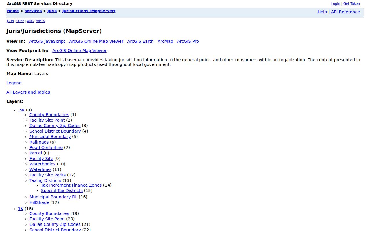
The layer catalog makes the distinction visible: postal geography helps route a search, while the parcel and recorded legal description answer a property-boundary question.
- ZIP versus ZIP+4
- A ZIP identifies a broad delivery area; ZIP+4 adds a more specific delivery segment.
- PO-box ZIP
- A code used for post-office box delivery and not necessarily for ordinary street delivery.
- Unique ZIP
- A special code for an institution, organization, or dedicated delivery arrangement.
- Carrier route
- A Postal Service delivery grouping that is more detailed than a broad ZIP area.
Note: When postal and local records disagree, preserve both sources and ask the applicable custodian which boundary controls.